Overview GIS Services
ESRI Product Development
As utilities look to develop, deploy and manage Esri’s ArcGIS Platform the iWater Inc., GIS team can help in many different areas. We have developed and configured custom ArcGIS applications as well as Esri Apps, WebApps, deployed ArcGIS Online content, ArcGIS Portal and manage these applications for utilities across North America. We understand that time is money and our team is very knowledgeable, precise and focused on our customers.
CAD/GIS Conversion
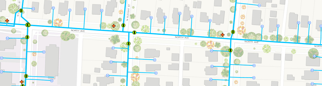
The iWater, Inc., GIS team assists water, wastewater, stormwater, gas and public works agencies to better update and manage assets. As technology progresses and GIS becomes the hub for asset management, we can help with this service to provide an Enterprise Asset Management program. iWater staff delivers enterprise geodatabase design, field verification and implementation for quick and effective deployment.
Features and Benefits
- Data Conversion
- As-Built Drawing Linking
- Geometric Network Design/GP Services for Water and Wastewater
- Data Model Creation
- On Going Support and Maintenance Management of GIS
- Esri Business Partner
On-Call Professional Services
Looking for knowledgeable staff to create, train, support Esri GIS data and software? From database design to deploying Esri products the iWater, Inc., professional services team is here to support your agency. We value our customers and know first-hand the challenges faced with maintaining data. As a field service provider for more than fifteen years we have maintained our own data, Esri products as well as provided solutions to our customers.